SNOWTRACK PRO
Snow height monitoring
SnowTrack uses LiDAR sensors to measure snow height. These sensors are placed on the buildings trusses facing downwards. These sensors measure the distance between the sensor and the ground. The distance is then converted into a height. This all happens in real time. These sensors then send the data to the SnowTrack Dashboard. Where operators and managers can see the data.
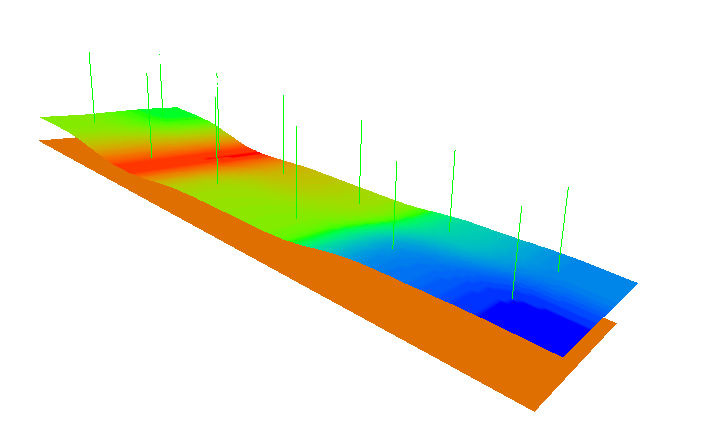
Data is easily accessible in shape of a heatmap, and 3D mesh. The heatmap shows the distribution of snow height. Where the highest, and lowest heights are located, and clearly colored. The 3D mesh shows easy visualisation of the distribution of snow height.
A mesh can be generated with as little as 8 sensors. But, the more sensors. The more accurate the mesh becomes.
Below is an example of a mesh generated with 12 sensors.
